Beartooth Highway
Why Ride It
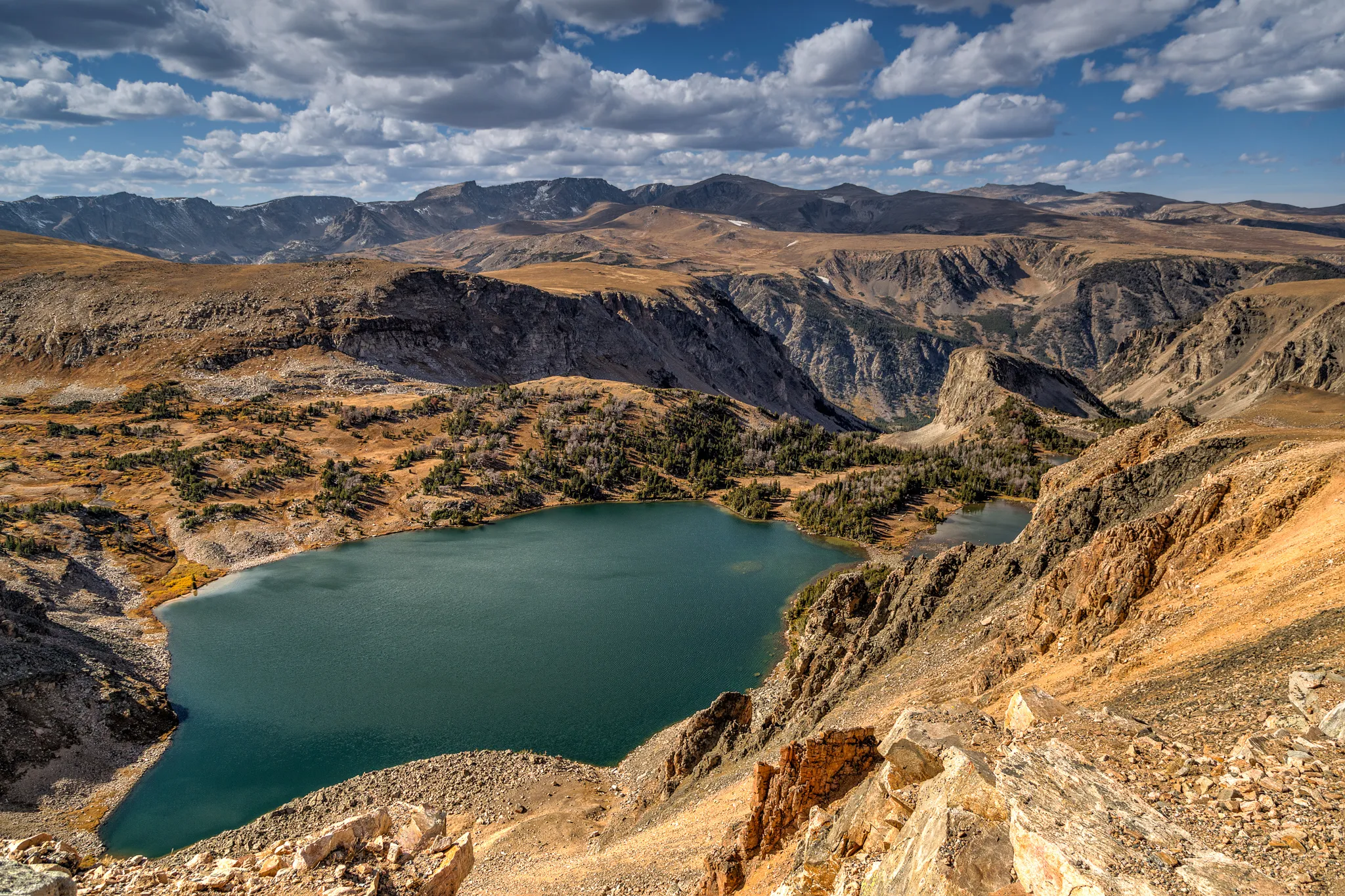
The Beartooth Highway is one of America’s great motorcycle roads, crossing the high mountains of southern Montana and northern Wyoming on US-212. Rising to 3,337 metres at Beartooth Pass, it is one of the highest paved roads in the United States and combines remarkable elevation with a road that was built to make the most of an extreme mountain landscape.
Leaving Red Lodge, the route climbs steadily into the Beartooth Mountains, with the road becoming increasingly exposed as it approaches the high country. Long sweeping bends are mixed with tighter switchbacks, while the landscape changes from forested mountain slopes to vast alpine plateaus, rocky peaks and small mountain lakes. The road rarely feels repetitive because every increase in altitude reveals another layer of the surrounding landscape.
For riders, the real attraction is the combination of riding freedom and scale. The corners are engaging without being dominated by hairpins, allowing a natural rhythm through much of the route. At the same time, the altitude, remoteness and rapidly changing mountain environment give the ride a genuine sense of adventure that is difficult to find on more developed mountain roads.
The Beartooth Highway feels less like a pass and more like a road across the roof of the American Rockies. Ride it for the corners, stay for the scale of the mountains.
Ride The Line
Good To Know
The Beartooth Highway is a seasonal mountain road and is normally closed during the winter because of heavy snowfall and extreme conditions. Weather can change rapidly at altitude, even during summer, and snow can remain beside the road well into the riding season. Wildlife is common in the surrounding mountains, while fuel and services are limited along the high section. Check current road conditions and opening status before setting out, particularly early or late in the season.
Picks
 Riding Gear
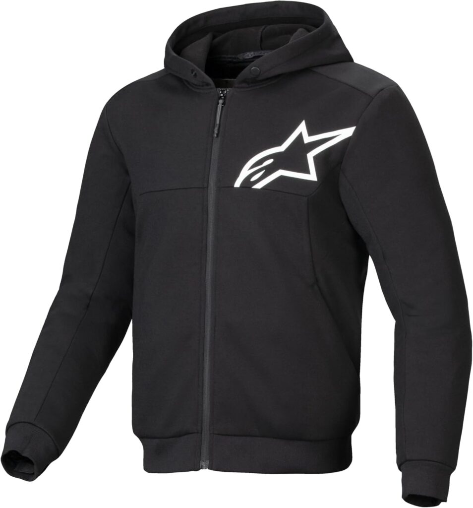
Alpinestars Chrome v2 Sport Hoodie
The Alpinestars Chrome v2 Sport Hoodie combines casual streetwear style with motorcycle-ready protection. Its reinforced construction and integrated armor provide added protection,…
View Product Maintenance
Tire Repair Kit
A heavy-duty 86-piece tire repair kit designed for quick and reliable tubeless puncture repairs on the road. Packed with essential tools and…
View Product Communication
Cardo Motorcycle Communication System
A compact motorcycle Bluetooth headset designed for clear rider-to-rider communication and hands-free connectivity on the road. With 32mm speakers, universal connectivity and…
View Product Maintenance
Portable Tire Inflator
A compact and portable electric tire inflator that makes it easy to check and top up tire pressure on the go. Lightweight…
View ProductRoute Notes
The Ride Beyond route begins in Red Lodge, where US-212 immediately starts climbing towards the Beartooth Mountains. The first section winds through forested slopes with a steady succession of bends as the road gains altitude. The climb becomes progressively more exposed as the route approaches the high mountain plateau.
The defining section begins as the road reaches the upper Beartooth Mountains. A series of sweeping corners and tighter switchbacks carries the route across increasingly open terrain, with Beartooth Lake and the surrounding peaks providing landmarks along the way. The road eventually reaches Beartooth Pass at 3,337 metres, the highest point of the route.
From the summit, the highway continues across the high plateau before beginning its descent towards Cooke City. The landscape remains dramatic for much of the descent, with broad mountain views gradually giving way to deeper valleys and forest as the route loses altitude.
The Beartooth Highway is best experienced as a complete crossing rather than a race to the summit. The road keeps changing, the landscape keeps opening up and the mountains make the scale of the ride impossible to ignore.