
Serra do Rio do Rastro
Why Ride It
The Serra do Rio do Rastro is one of South America’s most recognisable mountain roads, carved into the dramatic escarpment of Santa Catarina. The famous climb rises from Lauro Müller towards the highlands, with an extraordinary succession of bends cut into the mountainside. Rather than treating the iconic climb as a short standalone attraction, this Ride Beyond route continues through the surrounding highlands towards Urubici, turning one of Brazil’s most famous roads into a complete motorcycle journey.
The defining section is the climb itself. The road tightens as it rises, with successive hairpins stacking one above another along the steep mountainside. Dense vegetation surrounds the lower sections before the landscape opens towards the plateau, creating a noticeable change in both scenery and atmosphere. The riding demands concentration, particularly through the tighter corners and steeper sections, but the road remains engaging rather than relentlessly difficult.
Once above the escarpment, the character changes. The extreme hairpins give way to more flowing highland roads around Bom Jardim da Serra and São Joaquim, creating a welcome contrast after the main climb. Continuing towards Urubici adds distance and variety without taking away from the central experience: a dramatic ascent followed by an open ride across the mountains of southern Brazil.
Few roads make elevation gain feel quite as visible as the Serra do Rio do Rastro. The mountain does not simply surround the road — the road becomes part of the mountain itself.
Ride The Line
Good To Know
Weather can change rapidly on the Santa Catarina highlands, with fog, rain, strong winds and significantly cooler temperatures possible at elevation. Visibility can deteriorate quickly on the exposed upper sections, so extra caution is worthwhile in poor conditions. The hairpin section can also be used by slower vehicles, cyclists and local traffic, meaning the road should be ridden at a controlled pace rather than treated as a race track. Check local road conditions before setting out, particularly after heavy rain.
Picks
 Riding Gear
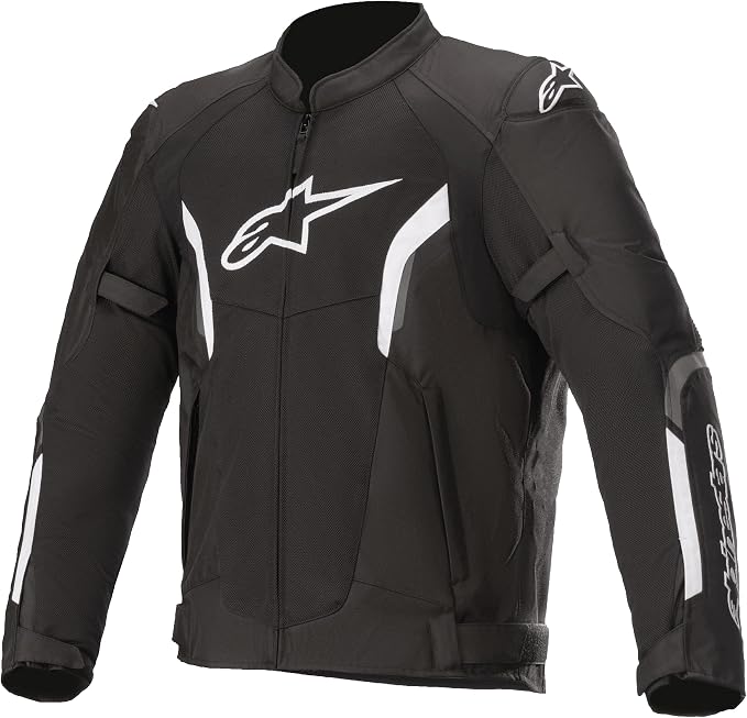
Alpinestars T-SPS Air V2
The Alpinestars T-SPS Air V2 is a lightweight, highly ventilated motorcycle jacket designed for warm-weather riding. With durable construction, protective armor and…
View Product Communication
Cardo Motorcycle Communication System
A compact motorcycle Bluetooth headset designed for clear rider-to-rider communication and hands-free connectivity on the road. With 32mm speakers, universal connectivity and…
View Product Maintenance
Tire Repair Kit
A heavy-duty 86-piece tire repair kit designed for quick and reliable tubeless puncture repairs on the road. Packed with essential tools and…
View Product Maintenance
Portable Tire Inflator
A compact and portable electric tire inflator that makes it easy to check and top up tire pressure on the go. Lightweight…
View ProductRoute Notes
The route begins in Lauro Müller, where the road starts climbing towards the Serra do Rio do Rastro. The first section gradually leaves the town behind as the terrain becomes steeper and the vegetation increasingly dense. The climb builds progressively before reaching the most spectacular section of the mountain road.
The defining section is the ascent towards the Serra do Rio do Rastro viewpoint and plateau. A dense sequence of hairpins winds up the escarpment, with the road repeatedly changing direction as it gains altitude. From the higher sections, the scale of the climb becomes clear, with expansive views back across the valley below.
After reaching the highlands, the route continues towards Bom Jardim da Serra and then São Joaquim. The riding becomes faster and more flowing, replacing the concentrated hairpin work with sweeping bends and open highland roads. The landscape also changes, with broad plateaus and cooler mountain conditions replacing the enclosed lower slopes.
The final section continues towards Urubici, giving the route a natural point-to-point finish. The journey is best treated as a progression from tight mountain riding to open highland cruising — two very different experiences connected by one of Brazil’s most spectacular roads.